TM 5-6675-325-14
NOTE
Factory determined RT value is given on Calibration Records sheet
provided with equipment.
Alinement is performed as a check.
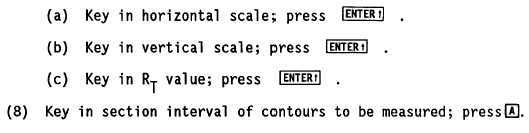
(7) Key in horizontal scale and vertical scale of contour map or photo and RT
value.
(9) Determine if object contour described is cut (excavation) or fill
(embankment).
(11) Press INIT to clear calculator.
(12) Key in value for elevation of first station point to be measured.
NOTE
If contour is cut, first station point elevation should be largest. If
contour is fill, first station point elevation should be smallest.
(13)
(14)
(15)
(16)
Stop when
When
Press
Place
Press
Trace
planimeter at starting point on boundary line of contour loop.
CLEAR button to clear auto-scaler.
boundary line of contour loop with dot in lens tracing assembly.
you reach starting point.
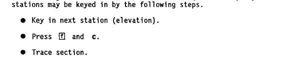
NOTE
running vertical sections. odd stations (elevations) may occur. Odd
5-80