TM 5-6675-318-14
Table 4-21. CODE DESCRIPTIONS - Cont
U -
X -
Y -
(3)
( 4)
Data from satellite was asymmetrical about point of closest approach.
L a s t s a t e l l i t e p a s s d a t a w a s t a k e n f r o m a s a t e l l i t e t h a t i n d i c a t e d w i t h in
its messsage that it should not be used for precise applications (i.e.,
n e g a t i v e s a t e l l i t e n u m b e r ).
Satellite pass data was taken from a satellite that was deleted by user.
Number of satellite passes used in the translocation position computation.
Distance in meters from the previously computed translocation position.
This value is meaningless for the first pass.
Press the enter (E) key. Display shows the computed latitude in degrees, minutes,
and seconds using satellite datum coordinates.
Computed Latitude
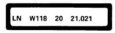
Press the enter (E) key. Display shows the computed longitude in degrees, minutes,
and seconds using satellite datum coordinates.
Computed Longitude
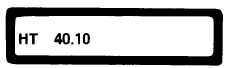
Press the enter (E) key. Display shows the computed geodetic height in meters,
u s i n g t h e s a t e l l i t e d a t u m.
Computed Geodetic Height
4-151